Parks | May 29, 2024
Making the First-Ever Map of Manhattan's Coastal Soils
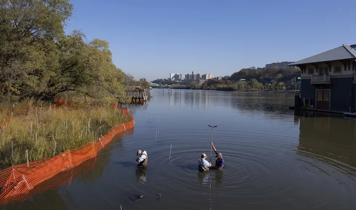 Last fall, USDA-NRCS soil scientists mapped Manhattan's coastal soils for the first time ever at Inwood's Sherman Creek Park. Credit: Ben Hider
 Is there any part of Manhattan that hasn’t been mapped? We have maps of its streets, subways, parks, gardens, trees, and pizza shops among many other specific interests. Poke around enough online, too, and it becomes increasingly difficult to imagine any part of this town that hasn’t been charted at some point by someone.
But what about the ground itself? How much do we know about the actual soil throughout the five boroughs? Until relatively recently, not that much.
New York City’s soil was technically unmapped as far as the federal government was concerned until 1995 when the United States Department of Agriculture’s Natural Resource Conservation Service (USDA-NRCS) began its New York City Soil Survey Program. This project sought to add New York City to the National Cooperative Soil Survey (NCSS), which has aimed “to investigate, inventory, document, classify, interpret, disseminate, and publish information about soils” across the country since 1899.
NCSS data primarily describes a soil’s physical and chemical properties, and this knowledge has informed land use decisions throughout the US for 125 years including deciding which crops to plant where, as well as what land is best suited for construction or conservation. In urban areas like New York, soil surveys are especially useful for identifying and protecting important habitat areas, as well as assessing a specific place’s suitability for redevelopment, remediation, and/or restoration.
“Ideally an urban soil survey will help guide the best use and management of the city’s open space,” writes former USDA-NRCS New Jersey State Soil Scientist Rich Shaw. “Our national soil survey program began [in the late nineteenth century] to help guide agricultural development when almost 40% of the U.S. population lived on farms. Now that we are a majority (80%) of urban dwellers, [NCSS] has worked hard to stay relevant to changing needs, although many cities still lack good soil survey information.”
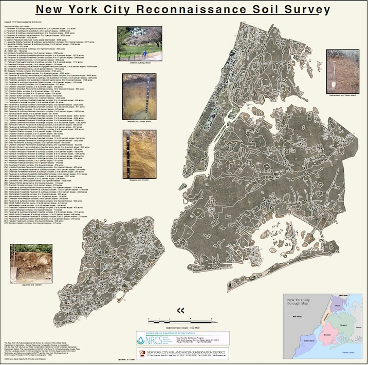
New York City Soil Survey Map (click for full file)
Expanding into urban areas has been one way the agency has evolved the survey’s mission over time, and Rich has played an influential role in this change as project leader for the New York City Soil Survey Program, which wrapped in 2013.
Another way USDA-NRCS has continued to expand the scope of the soil survey in more recent years has been mapping the country’s coastal soils. “Within the next decade, nearly three-fourths of the U.S. population is expected to live within 100 km of the coast,” cites USDA-NRCS. “This high population density, together with its associated commerce, pollution, and development, will put significant stress on these coastal and near-shore ecosystems.”
Called the Coastal Zone Soil Survey (CZSS), this expansion of the NCSS helps “to effectively study, manage, conserve, and sustain shallow-sub tidal ecosystems.” Like its terrestrial counterpart, CZSS findings can inform a wide spectrum of waterfront choices, including where best to grow shellfish or lay electrical cable for offshore wind turbines, as well as how best to protect and enhance existing carbon stocks (coastal wetlands annually sequester carbon at a rate ten times greater than mature tropical forests; they also store three to five times more carbon per equivalent area than tropical forests).
USDA-NRCS’s urban and coastal zone soil survey initiatives have rarely overlapped, but as a recent partnership with New York Restoration Project has shown, they can.
The CZSS team worked with NYRP last fall to survey Manhattan’s largest remaining wetland, which runs along the Harlem River at Inwood’s Sherman Creek Park. This waterfront park is part of the last remaining salt marsh environment predating European colonization on the entire perimeter of Manhattan, and the USDA-NRCS map of its underwater soils is the first of its kind ever charted in the borough.
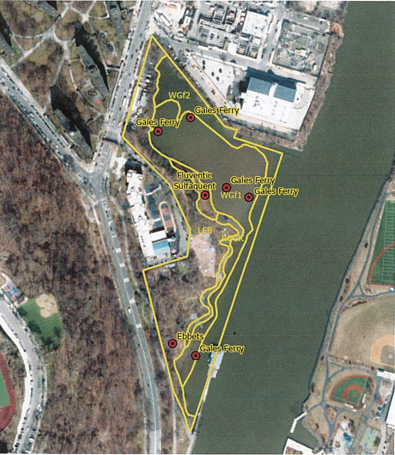
A tentative and preliminarily USDA-NRCS map of Sherman Creek Park’s intertidal zone: an environmentally critical area where New York City land and the Harlem River interact. Credit: USDA-NRCS
“Our survey with NYRP at Sherman Creek is one of the only ones we’ve ever done that’s both 100% urban and 100% coastal at the same time,” says USDA-NRCS Soil Scientist and Soil Carbon Specialist Reuben Wilson, who helped lead the work. “The Sherman Creek survey broke the barrier for our urban coastal zone work in densely populated areas.”
“We didn’t map any tidal marsh, and only a small amount of mud flats in Manhattan when we did the initial New York City soil survey,” responds Rich. “I think this work really opens the door for expanding our understanding of the city’s important coastal soils, and especially in land parcels that were too small for the initial survey’s scale. It’s a great addition to the existing data, and a good way to keep USDA-NRCS active here in NYC.”
Sherman Creek’s wetlands are admittedly tiny compared to the Jamaica Bay estuary in Queens, which is roughly the same size as Manhattan on its own (USDA-NRCS completed New York City’s first underwater soil survey at Jamaica Bay in 2020). However, that landscape is nowhere near as densely populated as the Inwood neighborhood surrounding Sherman Creek Park.
“Coastal zone soils are just as critical in smaller urban areas as they are in large ones because they are still performing very important environmental services,” says Reuben. “Sherman Creek is in an area that’s susceptible to sea level rise on top of being densely populated and economically underserved. It’s worth knowing what we can about the area’s soils since they’re helping preserve the Manhattan shoreline while storing carbon and improving water quality among other crucial ecosystem services for New Yorkers.”
The USDA-NRCS survey at Sherman Creek is a more recent chapter in New York Restoration Project’s decades-long stewardship of the park. In the nineties, NYRP partnered with NYC Parks to transform what was then a mucky dump into a now-thriving shoreline that’s home to an artificial oyster reef and some of the city’s best birdwatching habitat.
“I see participating in the Coastal Zone Soil Survey as a way to learn basic knowledge about our waterfront and how best to care for it,” says NYRP’s Director of Northern Manhattan Parks Jason Smith. “The knowledge we gain from it can help us answer questions like: what parts of this ecosystem should we protect? How can we help enhance this environment? How might this landscape change as sea levels rise? The survey helps provide us with foundational information for those big issues.”
The physical and chemical soil data USDA-NRCS gathered at Sherman Creek has both short- and long-term value for NYRP’s stewardship of the park. In only a few months, the findings have already informed research projects led by Pace University graduate students and helped NYRP assess its ongoing efforts to protect and enhance the park. This includes conserving the park’s carbon storage, which Reuben describes as being “more carbon dense than some of the traditional mineral marshes that USDA-NRCS has observed elsewhere.”
Another long term possibility for the Sherman Creek data is defining an entirely new soil series within the USDA-NRCS National Cooperative Soil Survey. There are more than 20,000 individual soil series in the US and each one represents a distinct type of soil. Defining a new series means assigning an identity to a previously unknown soil profile; it’s essentially the equivalent of finding a new species in soil science terms. “Technically speaking, we’ve never seen anything like it before,” says Reuben.
Sherman Creek’s underwater soils are unique in that they’re full of what USDA-NRCS calls “artifacts,” or “evidence of past human activity.” To make the series official, though, would require USDA-NRCS to survey more waterfronts in dense urban areas; if they find more artifact-rich coastal soils in urban environments, then they may officially define this new series. “For now, the work we did at Sherman Creek helps us establish a baseline for understanding what urban coastal soils may look like elsewhere as we continue this work,” says Reuben.
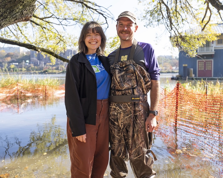
USDA-NRCS Soil Scientist Reuben Wilson (right) is the brother of NYRP’s Senior Director of Marketing and Communications Lauren Wilson (left). The siblings connected the dots between their work while home on their family’s farm in Bakersville, North Carolina. Credit: Ben Hider
Although Sherman Creek embodies both of USDA-NRCS’s urban and coastal soil survey initiatives, completing a survey at this exact location was never guaranteed. Reuben is the brother of NYRP’s Senior Director of Marketing and Communications Lauren Wilson. The siblings connected the dots between their work while home on their family’s farm in Bakersville, North Carolina. Lauren saw the potential for her brother’s expertise at Sherman Creek, and after learning that NYRP would have to apply to CZSS to participate*, she connected Reuben with Jason, who ultimately helped bring the project to life.
Hopefully the CZSS work started at Sherman Creek is just the beginning; USDA-NRCS’s Coastal Zone Soil Survey work throughout New York City is now ripe to expand and the agency encourages interested groups to reach out.* “The nice thing about working in urban areas is that there’s usually more potential partners,” says Reuben. “The more cooperators we have, the better since we want to benefit as many people as we can.”
“This shows me that there’s room for a lot more work in New York City,” adds Rich. “We’ve done a lot of upland work, but the USDA-NRCS and NYRP collaboration at Sherman Creek shows me that there’s so much more we can do to understand coastal soils throughout the city. This work has really opened the door.”
*If you steward an area that you feel could be a good candidate for the USDA-NRCS Coastal Zone Soil Survey, you can e-mail Reuben Wilson at [email protected] for further information.